Action B2. To improve the cost efficiency of domestic misconnection inspection using a GIS approach to optimise the detection rate of domestic misconnection vs. inspecting in the traditional ‘cold call’ door-to-door model. The results of this will support the decision support tool.
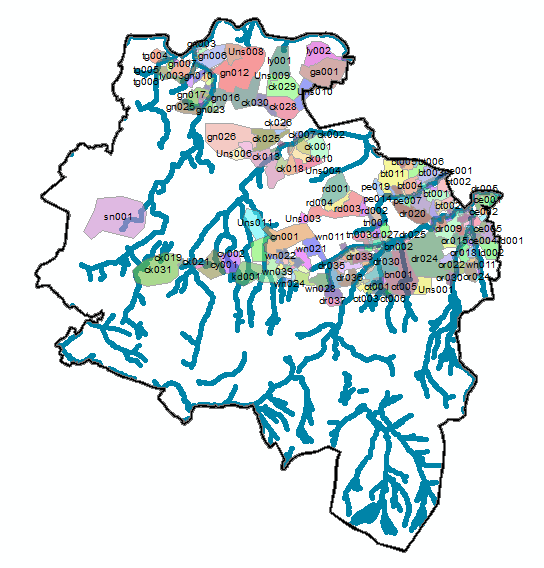
SDCC has prepared a GIS project detailing each storm water drainage sub-catchment location [# 259], its approximate size, outfall location and the number of housing units contained within. A similar examination of Dun Laoghaire-Rathdown county storm water drainage system will be undertaken during the project.
Misconnections cause a reduction in water quality in urban rivers making it harder to achieve Good Ecological Status (as per the WFD). This deterioration in water quality adversely impacts aquatic biodiversity (viz. Habitats and Birds Directive) and, in some instances, bathing water quality in receiving coastal waters. Identifying and resolving misconnections is a laborious task. It involves two local authority staff members conducting door-to-door inspections of each house in the catchment. It is proposed to optimise, or streamline, the door-to-door inspection programme during the project through the use of GIS data acquisition and analysis, which will be used to prioritise areas/houses that have a higher risk of misconnections and develop a replicable and transferable procedural tool to optimse resources and improve water quality.
The results from these GIS-based studies will inform and prioritise areas at most risk for immediate inspection and will make far better use of limited municipal resources. This novel approach to prioritising inspections based on GIS-generated information will also be trailed in other local authority areas that are currently carrying out misconnection inspections and will be designed to be easily replicable and transferable across national and international regions.
The GIS project resource will use GIS methods (e.g. ArcMap 10.2) to develop a feedback tool that will incorporate up to date GIS risk analyses with live data from door-to-door inspections. In addition, visual analyses of satellite imagery will identify areas of increased risk of misconnection (e.g. housing extensions, habitable outbuildings, etc.). A misconnection risk analysis will be carried out using the above data but, adding to the novelty value of the tool, it will be continually supported and re-evaluated through the results from the door-to-door inspections (B3), which will continually feedback and validate the decision support tool.


